
Home Insurance in Point Pleasant, NJ
Stonebrook is an independent insurance agency, protecting New Jersey homeowners since 1982 from our office in nearby Lakewood. Point Pleasant, often called Point Boro, sits between the Manasquan River, Beaver Dam Creek and Barnegat Bay, with the Point Pleasant Canal running through the middle. It is a separate town from Point Pleasant Beach, its oceanfront neighbor, which may get its own page. Here is what matters most for Point Pleasant homes. New to home insurance? Start with our home insurance guide.

Reviewed by Nate Feuerman, High Net Worth Insurance Producer at Stonebrook
Updated
Quick answers for Point Pleasant homeowners
Is Point Pleasant the same as Point Pleasant Beach?
No. They are two separate boroughs. Point Pleasant, sometimes called Point Boro or West Point Pleasant, is the larger inland town on the river, canal and bay.
Is Point Pleasant considered coastal for home insurance?
Yes, for most carriers. The borough has no beach, but its eastern edge is about half a mile from the ocean and it is surrounded by tidal water.
Do I need flood insurance in Point Pleasant?
Most Point Pleasant homeowners should have it, and it is required if you have a federally backed mortgage on a home in a high-risk zone.
What is a hurricane or wind deductible?
It is a separate, higher deductible for storm damage, usually a percentage of your dwelling limit instead of a flat dollar amount.
From Brick Township woods to a borough on the water.
The Lenape called this area the “Land of Tall Timber.” Fishermen, farmers and boat builders settled here from about 1665, and it became part of Brick Township when Ocean County was created in 1850. The borough was carved out of Brick by the Legislature on April 21, 1920 and confirmed by referendum on May 19, 1920. Its name comes from neighboring Point Pleasant Beach, at the northern tip of the Barnegat Peninsula. The post office used the name “West Point Pleasant” until 1956, and many longtime residents still do.
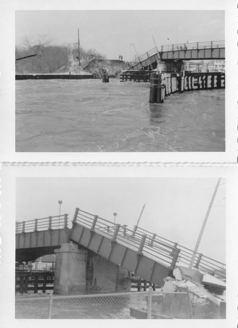
In 1925 the Manasquan River–Bay Head Canal opened through the middle of town. It was renamed the Point Pleasant Canal in 1964 because it lies entirely within the borough. The water has shaped the town ever since. In the Ash Wednesday Storm of March 1962, surge and tides took out a section of the Lovelandtown Bridge over the canal. A new lift bridge opened in 1972.
Today Point Pleasant is a year-round town of 4.17 square miles, about 16% of it water. It is separate from both Point Pleasant Beach and Bay Head to the east. Neighborhoods include Lovelandtown by the canal, lagoon communities like Sunshine Harbor (about 250 homes east of Beaver Dam Road) and Lagoona Village, and Bay Head Shores on Barnegat Bay. It had 18,392 residents in 2010 and 18,941 in 2020.
“In Point Pleasant, almost every insurance conversation starts with the water.”
Things to see in Point Pleasant.
A canal through the middle of town, a river on one side and a creek on the other.
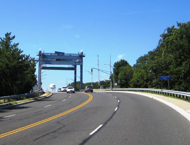
The Point Pleasant Canal
A 2-mile canal, completed in 1925, that links the Manasquan River to Barnegat Bay as the northernmost leg of New Jersey’s Intracoastal Waterway. Its two lift bridges, on Route 88 and the Lovelandtown Bridge on Bridge Avenue, can open as many as 300 times a day in summer.
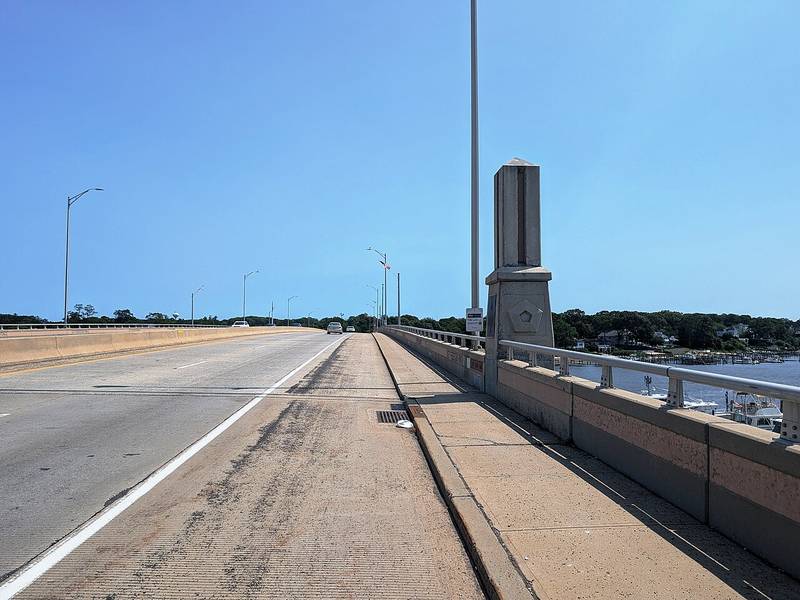
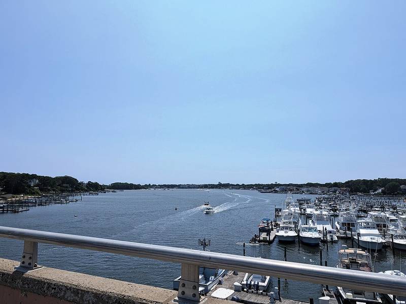
The Manasquan River and the September 11th Memorial Bridge
Route 70 crosses the river from Point Pleasant into Brielle on a bridge dedicated to Monmouth and Ocean County residents who died on September 11. The $52 million replacement bridge was finished in September 2008.
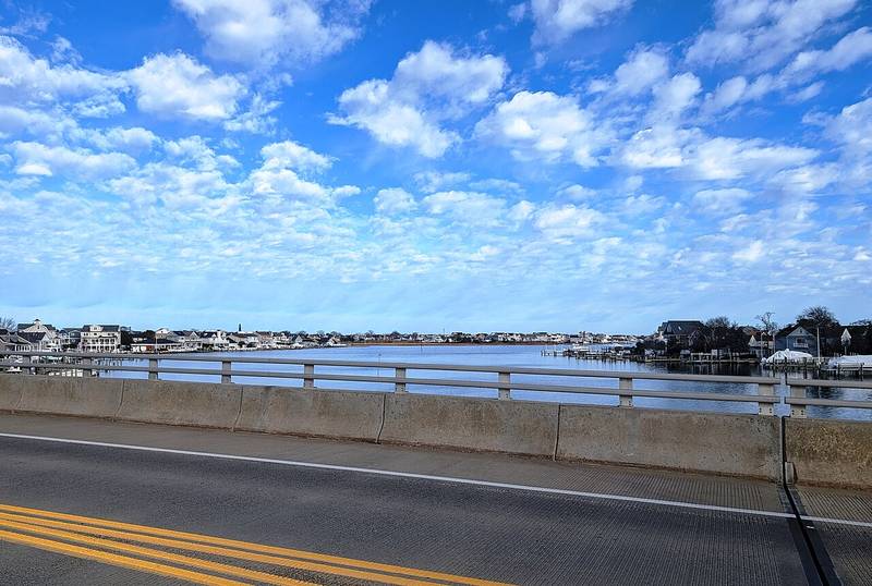
Beaver Dam Creek
The borough’s southern border with Brick, lined with docks and waterfront homes. Seen here from the Beaver Dam Road bridge (County Route 630), looking toward Barnegat Bay.
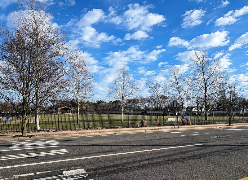
Community Park
A fenced borough park with an open lawn and a pavilion on Beaver Dam Road, near the Point Pleasant Borough branch of the Ocean County Library.
Beaver Dam Creek County Park
An Ocean County park at 3430 Bridge Avenue, with a boardwalk, walking path, playground, fields and tennis courts.
Point Pleasant Borough Library
The Ocean County Library’s branch on Beaver Dam Road closed in January 2026 for repairs after water was found in several areas following a storm.
Point Pleasant-specific insurance knowledge.
How close is the coast?
Point Pleasant has no ocean beach, but the ocean is close. The beaches belong to Point Pleasant Beach and Bay Head. The borough’s eastern edge is about half a mile from the ocean, and its western edge is about 3 miles away. And the town is surrounded by tidal water: the Manasquan River to the north, Beaver Dam Creek and Barnegat Bay to the south, and the canal through the middle. Many carriers price wind and hurricane risk by distance to the coast, so most addresses here are treated as coastal. Expect hurricane or wind deductibles, and some carriers limit new policies near the water. It depends on the carrier and the address.
Hurricanes and Sandy
Sandy was not a hurricane when it came ashore near Brigantine on October 29, 2012, as a post-tropical cyclone, so New Jersey hurricane deductibles did not apply. It still flooded Point Pleasant’s waterfront. The borough ordered a mandatory evacuation that day. Overnight, the roads supervisor and two divers used the borough’s largest front-end loader to rescue 152 people and 50 to 60 pets. In Sunshine Harbor, only a small share of the roughly 250 homes stayed dry on the first floor, and many were left uninhabitable. Some residents were without power for 22 days, and crews filled debris containers more than 900 times.
“During Sandy, the borough’s roads supervisor and two divers rescued 152 people.”
Nor’easters and wind
Nor’easters bring the wind and the water together here. The Ash Wednesday Storm of 1962 hit Lovelandtown hard: roads became rivers, residents were stranded and the Lovelandtown Bridge collapsed. During Sandy, sustained winds of 50 to 60 mph brought down trees across town, and a nor’easter days later pushed 9 inches of water into a Middle Avenue home. On June 9, 2021, thunderstorms cut power to 3,474 JCP&L customers in the borough.
Fire
Wildfire risk in Point Pleasant is low. It is a built-up town outside the Pinelands. If your home backs onto woods or marsh, keep brush and dead branches cleared.
Rain and flooding
Flood is the biggest risk in Point Pleasant. The borough has been in the National Flood Insurance Program since 1972. After Sandy, FEMA’s advisory maps put parts of town in V zones, where waves of 3 feet or more are expected, including Bay Head Shores on Barnegat Bay. Glenwood Avenue was split between A and V zones. Officials disputed some of the lines but adopted the maps in February 2013 so residents could rebuild and qualify for elevation funding. Your zone and your home’s elevation certificate drive what flood insurance costs. Since March 2024, New Jersey sellers and landlords must disclose flood history and FEMA zone. Flood is a separate policy. We also recommend at least $25,000 of water backup coverage.
Home values and your dwelling limit
The U.S. Census Bureau puts the median value of an owner-occupied home in Point Pleasant at $575,300 (2020–2024 American Community Survey). Waterfront and newly elevated homes often run much higher. Rebuild cost is a different number from market value, so check your limit against our 2026 guideline of about $250 per square foot.
Check your Point Pleasant home in two minutes.
Three quick checks for any Point Pleasant home insurance policy.
1. Dwelling coverage guideline
Our 2026 starting point is about $250 per square foot. Custom finishes cost more.
2. Hurricane deductible
A percentage deductible applies to hurricane or wind damage, not to every claim.
3. Your flood zone
Look up your address on FEMA’s official flood map. Zones starting with A or V are high risk, and a lender will usually require flood insurance there. Homes outside those zones can still flood.
Check my flood zone on FEMA’s mapNot sure how to read it? Send us your address and we’ll tell you what it means for your Point Pleasant home.
What Point Pleasant homeowners should ask about.
- 01
Flood insurance and elevation certificates
Homeowners policies exclude flood, so it takes a separate flood policy, through the NFIP or a private carrier. An elevation certificate from a licensed surveyor, engineer or architect records how high your first floor sits. It can lower your flood premium. Ask the seller, the builder or the borough if one is already on file.
- 02
Hurricane and wind deductibles
Near the water, many policies carry a separate deductible that is a percentage of your dwelling limit. On a $600,000 home, 2% is $12,000. Check what triggers yours and how high it is.
- 03
Elevated homes and renovations
Many homes here were raised or rebuilt after Sandy. Raising a house, adding a floor or finishing space raises rebuild cost, but your dwelling limit often stays the same. We like to see about $250 per square foot as a starting point. Flood policies cover little below an elevated home’s first floor, so ask what is covered there.
- 04
Water backup and winter storms
Heavy rain and high tides can back up drains, and an outage can stop your sump pump. Keep at least $25,000 of water backup. It is not flood coverage, so you need both.
- 05
Apartments, ADUs and summer rentals
A rental unit, a downstairs apartment or an ADU makes your home a multifamily dwelling to the carrier. You may need a landlord or dwelling fire policy (DP-3). Renting for the summer can change the policy too. Tell the carrier.
- 06
Docks, pools and an umbrella
Docks, bulkheads and boats may need their own coverage, and guests on a dock or in a pool raise your liability. Ask about higher liability limits and an umbrella policy, and tell us about pools, dogs and temporary structures like a sukkah.
- 07
Valuables and vacation homes
Standard policies often cap jewelry and silver theft at a few thousand dollars. Schedule jewelry, watches and silver Judaica item by item. Own a home in Florida or elsewhere? We place home coverage in all 50 states.
“Your flood zone and your elevation certificate drive what flood insurance costs.”
Stonebrook is an independent insurance agency.
We don’t work for one insurance company.
We work with more than 25 carriers and compare coverage for your Point Pleasant home. If another carrier fits your home better, we can place it there. Protecting New Jersey homes since 1982.
What clients say about Stonebrook.
“Very honest they go above and beyond to find you the best rate and if you have a better rate he won’t try upselling you on something that you don’t need thank you Nate !!”
“This is the best insurance broker in Lakewood and surrounding areas they are honest and not pushy at all it was a pleasure talking to Nate they have the best rates that I have found thanks! Definitely recommend as top 5!”
“Working with Ruth from Stonebrook was a pleasure she was knowledgeable and super helpful on giving me a auto insurance quote for my cars in Lakewood”
Point Pleasant home insurance questions, answered.
What is an independent insurance agency?
An independent agency works with many insurance companies instead of one. Stonebrook is independent and compares more than 25 carriers for your Point Pleasant home.
Is Point Pleasant the same as Point Pleasant Beach?
No. They are two separate boroughs. Point Pleasant, sometimes called Point Boro or West Point Pleasant, is the larger inland town on the river, canal and bay. Point Pleasant Beach is the oceanfront borough to the east, with the boardwalk and the inlet. Bay Head is a third, separate borough.
Is Point Pleasant considered coastal for home insurance?
Yes, for most carriers. The borough has no beach, but its eastern edge is about half a mile from the ocean and it is surrounded by tidal water. Expect hurricane or wind deductibles. How a carrier rates your home depends on the carrier and the address.
Do I need flood insurance in Point Pleasant?
Most Point Pleasant homeowners should have it, and it is required if you have a federally backed mortgage on a home in a high-risk zone. Homeowners policies exclude flood, and Sandy flooded homes along the river, the lagoons and Beaver Dam Creek. Ask us to quote both NFIP and private flood.
How do I check if my address is in a flood zone?
Search your address on FEMA’s Flood Map Service Center at msc.fema.gov. It shows your zone, such as AE or VE. An elevation certificate shows how high your home sits compared with the expected flood level, and it can lower your premium. Homes outside a mapped zone can still flood, so ask us either way.
How much does home insurance cost in Point Pleasant?
It depends on your home, your carrier and your distance from the water. For reference, NerdWallet put New Jersey’s average at $2,030 a year in 2026 for a sample policy with $600,000 of dwelling coverage. Flood insurance is a separate cost. We compare more than 25 carriers to find the right price for your home.
What is a hurricane or wind deductible?
It is a separate, higher deductible for storm damage, usually a percentage of your dwelling limit instead of a flat dollar amount. A 2% deductible on a $600,000 home is $12,000. Check what triggers yours and how high it is.
Does my homeowners policy cover a neighbor’s tree falling on my house?
Usually, yes. Your own policy typically pays to repair your house, minus your deductible, no matter whose yard the tree grew in. The neighbor is generally responsible only if they were negligent, for example if they ignored a tree they knew was dead.
Is my sukkah covered?
Often, but check your policy. A sukkah is usually treated as an other structure or as personal property, and wind damage to it may be covered. Liability coverage applies to guests who get hurt, so make sure your limits are high enough.
Do I need to tell my insurance company about a basement apartment?
Yes. A separate unit that someone lives in, in the basement, on the ground floor or over the garage, can make your home a multifamily dwelling to the carrier. You may need a landlord or dwelling fire policy (DP-3), and tenants may need renters insurance. Disclose the unit to avoid problems at claim time.
How much dwelling coverage should I have in Point Pleasant?
As of 2026, we like to see about $250 per square foot of living space as a starting point, and more for custom finishes. If your home was raised or rebuilt, make sure your limit reflects it.
Can Stonebrook insure a vacation home outside New Jersey?
Yes. We place home coverage in all 50 states through our carriers and partners.
Nearby towns we cover.
Every town has its own risks. See what matters for homes near Point Pleasant.
Get a free second opinion on your Point Pleasant policy.
- Upload your declarations page. It’s the summary page of your policy, usually 1–3 pages. A photo works.
- We check it against your Point Pleasant home. Dwelling limit, water backup, wind deductible, flood, liability and valuables.
- You get a plain answer. What’s fine, what’s missing, and whether one of our 25+ carriers can do better. No pressure.
Send us your policy.
We’ll look it over and get back to you with a plain answer.
Let’s make sure your Point Pleasant home is covered correctly.
Take 30 seconds to take the first step towards better coverage.
Get a quote.
Tell us what you need and we’ll take it from there.
Sources (23)
Facts on this page come from these public sources. Figures are as of the dates shown in the text.
- en.wikipedia.org · Point Pleasant, New Jersey
- en.wikipedia.org · Point Pleasant Canal
- en.wikipedia.org · New Jersey Route 13
- en.wikipedia.org · New Jersey Route 70
- pphsm.org · 2025 04 april newsletter ash wed storm of 62 and tomaino 7
- pphsm.org · 2026 09 sept email newsletter formation of point boro
- census.gov · PST045223
- patch.com · front end loader rescues night point boro mans sandy memories
- patch.com · sunshine harbor gives point boro officials some heat
- patch.com · point boro fights fema flood map
- patch.com · with reluctance point boro adopts flood maps
- patch.com · more 7k without power point peasant boro beach
- webarchive.library.unt.edu · cis
- agents.floodsmart.gov · fema nfip understanding elevation certificates fact sheet 03 2023
- amp.insurancejournal.com · 19
- shorebeat.com · point pleasant borough library to close following water damage
- atly.com · BeaverDamCreekCountyPark
- pointpleasantnj.macaronikid.com · parks and playgrounds
- weather.gov · sandyreport
- nerdwallet.com · homeowners insurance nj
- consumerreports.org · when a tree falls who pays for the damage
- msc.fema.gov
- nominatim.openstreetmap.org (borough boundary used for distance estimates)
Photo credits
- “Manasquan River downstream from NJ Route 70, July 2026” by Mr. Matté, CC BY-SA 4.0. Source: Wikimedia Commons
- “Lovelandtown bridge collapse over the Point Pleasant Canal in 1962” by Jay Pilling, CC BY-SA 4.0. Source: Wikimedia Commons
- “NJ 13 Lovelandtown Bridge (1)” by Mr. Matté, CC BY 4.0. Source: Wikimedia Commons
- “NJ Route 70 eb on September 11 Memorial Bridge, July 2026” by Mr. Matté, CC BY-SA 4.0. Source: Wikimedia Commons
- “Beaverdam Creek downstream from Beaver Dam Bridge, NJ, Dec. 2024” by Mr. Matté, CC BY-SA 4.0. Source: Wikimedia Commons
- “Community Park, Point Pleasant, NJ, Dec. 2024” by Mr. Matté, CC BY-SA 4.0. Source: Wikimedia Commons


